Welcome to the Virtual Education Wiki ~ Open Education Wiki
File:New Zealand towns and cities.jpg
Jump to navigation
Jump to search
No higher resolution available.
New_Zealand_towns_and_cities.jpg (480 × 599 pixels, file size: 108 KB, MIME type: image/jpeg)
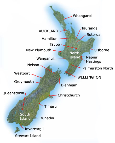
Topographic map of New Zealand with islands and main population centres labelled
This work is in the public domain in the United States because it is a work of the United States Federal Government under the terms of Title 17, Chapter 1, Section 105 of the US Code.
File history
Click on a date/time to view the file as it appeared at that time.
| Date/Time | Thumbnail | Dimensions | User | Comment | |
|---|---|---|---|---|---|
| current | 16:38, 16 December 2008 | | 480 × 599 (108 KB) | Theo.bastiaens (talk | contribs) | Topographic map of New Zealand with islands and main population centres labelled This work is in the public domain in the United States because it is a work of the United States Federal Government under the terms of Title 17, Chapter 1, Section 105 of th |
You cannot overwrite this file.
File usage
The following page uses this file: